![](/images/other/stat-length.png)
![Tocht Stappen Le Diamant - le Diamant de Taupinière vers O'mulane bas. - Photo](https://media.geolcdn.com/t/1900/400/653f0fe3-b889-4758-982c-8d8f505a6e15.jpg&format=pjpeg&maxdim=2)
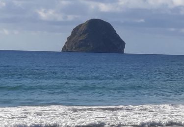
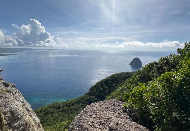
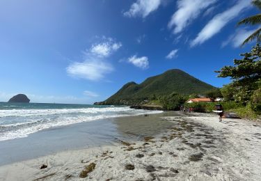
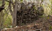
le Diamant de Taupinière vers O'mulane bas.
GabyG
Gebruiker GUIDE
![Lengte](/images/other/stat-length.png)
Lengte
5 km
![Max. hoogte](https://static1.geolcdn.com/siteimages/upload/files/1508320355ic_sort_altitude_max_24dp.png)
Max. hoogte
19 m
![Positief hoogteverschil](https://static1.geolcdn.com/siteimages/upload/files/1508320355ic_sort_den_pos_24dp.png)
Positief hoogteverschil
42 m
![Km-Effort](/images/other/stat-length.png)
Km-Effort
5,5 km
![Min. hoogte](https://static1.geolcdn.com/siteimages/upload/files/1508320355ic_sort_altitude_min_24dp.png)
Min. hoogte
0 m
![Negatief hoogteverschil](https://static1.geolcdn.com/siteimages/upload/files/1508320355ic_sort_den_neg_24dp.png)
Negatief hoogteverschil
41 m
![Boucle](https://static1.geolcdn.com/siteimages/upload/files/16400158638029165_repeat_loop_refresh_sync_direction_icon.png)
Boucle
Ja
Datum van aanmaak :
2024-05-12 12:57:30.255
Laatste wijziging :
2024-05-12 15:03:19.085
![Stappen](https://static1.geolcdn.com/sitytour/trail-icons/101.png)
2h05
Moeilijkheid : Gemakkelijk
![Scan deze QR-code om de tocht te openen in de SityTrail-applicatie](https://capi.geolives.com/qq0zvz2zws4bq2lad0pu/sitytour/trails/4051932/qr.png?size=200)
Gratisgps-wandelapplicatie
Over ons
Tocht Stappen van 5 km beschikbaar op Martinique, Onbekend, Le Diamant. Deze tocht wordt voorgesteld door GabyG.
Beschrijving
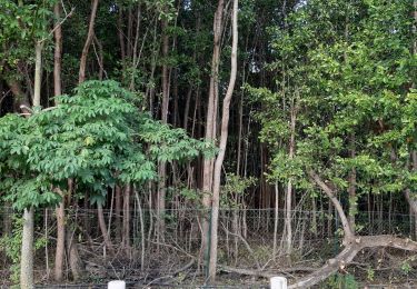
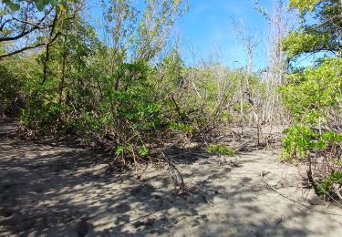
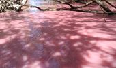
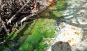
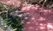
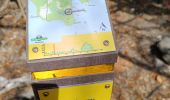
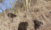
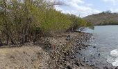
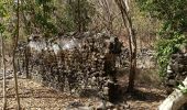
Randonnées du dimanche, visite de la mangrove rose.
Plaatsbepaling
Land:
France
Regio :
Martinique
Departement/Provincie :
Onbekend
Gemeente :
Le Diamant
Locatie:
Unknown
Vertrek:(Dec)
Vertrek:(UTM)
716422 ; 1601802 (20P) N.
Opmerkingen
Wandeltochten in de omgeving
![Tocht Stappen Le Diamant - O'Mullane bas vers la chérie en boucle. - Photo](https://media.geolcdn.com/t/375/260/a195cd15-3add-4893-b6af-9a931553ed21.jpg&format=jpg&maxdim=2)
![Stappen Stappen](https://static1.geolcdn.com/sitytour/trail-icons/101.png)
O'Mullane bas vers la chérie en boucle.
Stappen
Medium
Le Diamant,
Martinique,
Onbekend,
France
![](/images/other/stat-length.png)
4,9 km | 5,8 km-effort
2h 0min
![](https://static1.geolcdn.com/siteimages/upload/files/16400158638029165_repeat_loop_refresh_sync_direction_icon.png)
Ja
![Tocht Stappen Le Diamant - Dizac vers la maison du Bagnard - Photo](https://media.geolcdn.com/t/375/260/03163f2d-f1ea-4321-9fa3-308ef029cc2b.jpg&format=jpg&maxdim=2)
![Stappen Stappen](https://static1.geolcdn.com/sitytour/trail-icons/101.png)
Dizac vers la maison du Bagnard
Stappen
Heel gemakkelijk
Le Diamant,
Martinique,
Onbekend,
France
![](/images/other/stat-length.png)
3,2 km | 3,8 km-effort
56min
![](https://static1.geolcdn.com/siteimages/upload/files/16400158638029165_repeat_loop_refresh_sync_direction_icon.png)
Neen
![Tocht Stappen Sainte-Luce - fond Larion Plage de desert - Photo](https://media.geolcdn.com/t/375/260/66d5ec91-ffd1-4df1-bf0c-5ef46cd79d56.jpg&format=jpg&maxdim=2)
![Stappen Stappen](https://static1.geolcdn.com/sitytour/trail-icons/101.png)
fond Larion Plage de desert
Stappen
Heel gemakkelijk
Sainte-Luce,
Martinique,
Onbekend,
France
![](/images/other/stat-length.png)
6 km | 6,7 km-effort
1h 24min
![](https://static1.geolcdn.com/siteimages/upload/files/16400158638029165_repeat_loop_refresh_sync_direction_icon.png)
Ja
![Tocht sport Le Diamant - Dizac longuet morne Larcher - Photo](https://media.geolcdn.com/t/375/260/6e68aea7-4d41-4e88-81ff-8c701163409e.jpg&format=jpg&maxdim=2)
Dizac longuet morne Larcher
sport
Heel gemakkelijk
Le Diamant,
Martinique,
Onbekend,
France
![](/images/other/stat-length.png)
10,9 km | 19,4 km-effort
Onbekend
![](https://static1.geolcdn.com/siteimages/upload/files/16400158638029165_repeat_loop_refresh_sync_direction_icon.png)
Ja
![Tocht Stappen Le Diamant - Taupinière/La Cherry - Photo](https://media.geolcdn.com/t/375/260/b9a74ea8-943a-4470-8c3f-598130394046.jpg&format=jpg&maxdim=2)
![Stappen Stappen](https://static1.geolcdn.com/sitytour/trail-icons/101.png)
Taupinière/La Cherry
Stappen
Medium
Le Diamant,
Martinique,
Onbekend,
France
![](/images/other/stat-length.png)
9,5 km | 11 km-effort
2h 1min
![](https://static1.geolcdn.com/siteimages/upload/files/16400158638029165_repeat_loop_refresh_sync_direction_icon.png)
Ja
![Tocht Stappen Le Diamant - La Cherry/Taupinière/La Cherry - Photo](https://media.geolcdn.com/t/375/260/14edaf12-c346-4f56-9f09-e8deb58a7e6e.jpg&format=jpg&maxdim=2)
![Stappen Stappen](https://static1.geolcdn.com/sitytour/trail-icons/101.png)
La Cherry/Taupinière/La Cherry
Stappen
Medium
Le Diamant,
Martinique,
Onbekend,
France
![](/images/other/stat-length.png)
12,5 km | 14,7 km-effort
2h 43min
![](https://static1.geolcdn.com/siteimages/upload/files/16400158638029165_repeat_loop_refresh_sync_direction_icon.png)
Ja
![Tocht Stappen Le Diamant - Grottes marines Diamant - Photo](https://media.geolcdn.com/t/375/260/1a781571-dc81-4504-bb34-8e797f07bd72.jpg&format=jpg&maxdim=2)
![Stappen Stappen](https://static1.geolcdn.com/sitytour/trail-icons/101.png)
Grottes marines Diamant
Stappen
Medium
Le Diamant,
Martinique,
Onbekend,
France
![](/images/other/stat-length.png)
7,4 km | 10,7 km-effort
2h 25min
![](https://static1.geolcdn.com/siteimages/upload/files/16400158638029165_repeat_loop_refresh_sync_direction_icon.png)
Ja
![Tocht Stappen Le Diamant - Taupinière - Photo](https://media.geolcdn.com/t/375/260/06e6b9bd-5318-4c5f-964c-23c5f7329806.jpg&format=jpg&maxdim=2)
![Stappen Stappen](https://static1.geolcdn.com/sitytour/trail-icons/101.png)
Taupinière
Stappen
Heel gemakkelijk
Le Diamant,
Martinique,
Onbekend,
France
![](/images/other/stat-length.png)
6,8 km | 8,1 km-effort
1h 48min
![](https://static1.geolcdn.com/siteimages/upload/files/16400158638029165_repeat_loop_refresh_sync_direction_icon.png)
Ja
![Tocht Stappen Le Diamant - Taupinière - Mullane Bas - Photo](https://media.geolcdn.com/t/375/260/8cfab009-1357-419a-ac8c-bdc83f3122ae.jpg&format=jpg&maxdim=2)
![Stappen Stappen](https://static1.geolcdn.com/sitytour/trail-icons/101.png)
Taupinière - Mullane Bas
Stappen
Heel gemakkelijk
Le Diamant,
Martinique,
Onbekend,
France
![](/images/other/stat-length.png)
5 km | 5,7 km-effort
2h 37min
![](https://static1.geolcdn.com/siteimages/upload/files/16400158638029165_repeat_loop_refresh_sync_direction_icon.png)
Neen